 Maximize
 Maximize
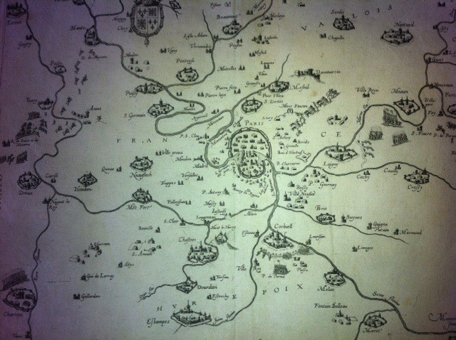
ISLE DE FRANCE ET LIEUX CIRCOVOYSINS : Paris and surrounding areas Jean Le Clerc of "Geographic Theatre of the Kingdom of France." The campaign is shown during the war, knights, cannons, battalions of pikemen and supply carts are figured. The towns of Lagny and Corbeil are besieged. . Le Clerc was the fourth generation of a family of booksellers and printers in Liège. Tours refugee with his family, he worked with Mr. Bouguereau and made his own atlas. Le Clerc died in 1621 or 1622, but the atlas continued to be published after his death at his widow. Cartographer: J. THE CLERK place and date of publication: Paris 1622 2 slots in the margins, otherwise very good condition.
2 other products in the same category:


