Maximize
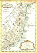
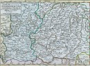
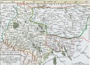
ISLES PHILIPPINES
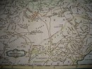
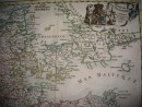
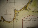
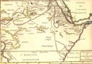
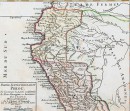
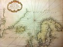
CARTE DES ISLES PHILIPPINES Dressée sur la Carte Espagnole du R.P. Murillo de Velarde. Ière Feuille Pour servir à l'Histoire Genérale des Voyages. Par le Sr Bellin Ing. de la Marine. 1752.
Maximize
CARTE DES ISLES PHILIPPINES Dressée sur la Carte Espagnole du R.P. Murillo de Velarde. Ière Feuille Pour servir à l'Histoire Genérale des Voyages. Par le Sr Bellin Ing. de la Marine. 1752.
Beautiful engraved map of the northern part of the Philippine archipelago with the island of Luzon and its capital Manila. Erected on the map of Murillo Velarde, geographer of the Society of Jesus, living in Manila, charged in 1734 to chart the Philippines for the king of Spain.
21.5 x 16 cm, watercolored by hand, 1752. Fine copy. SOLD
30 other products in the same category: